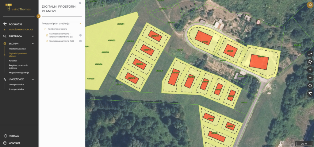
Saint Thomas application is an innovative web GIS solution that enables users to view existing spatial plans, cadastral parcels, the register of spatial units, and other spatial data related to spatial planning. In addition to viewing, it also allows the creation of the graphical part of digital spatial plans. Users can view building possibilities for individual parcels in zones where construction is planned.
Client:
GLOBAL GEOMATICA d.o.o.Year:
2022 - today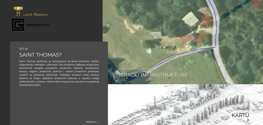
Solution
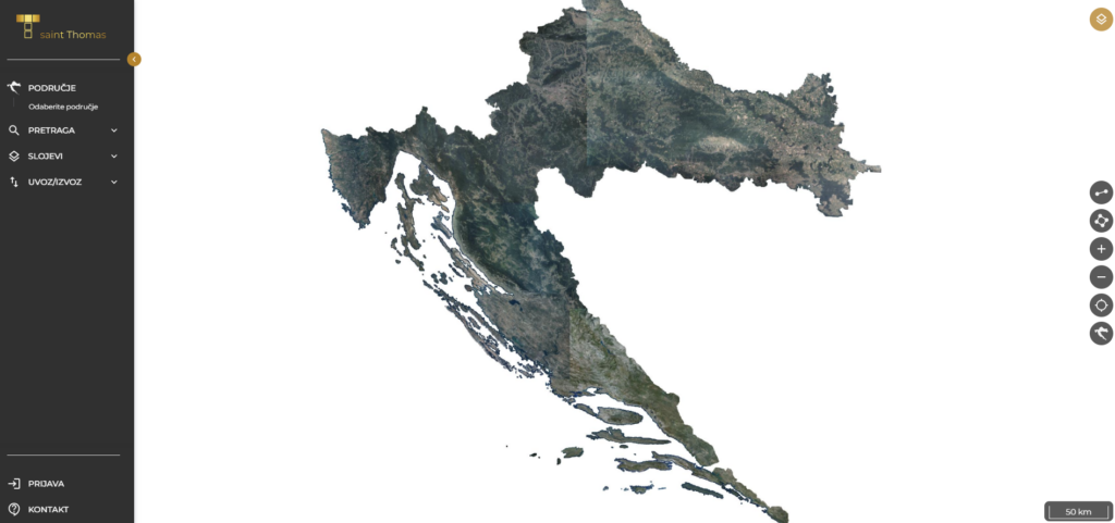
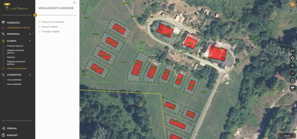
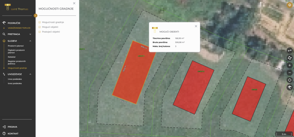
The application is designed as a tool for creating the graphical part of digital spatial plans, but it also enables the development of infrastructure. The greatest innovation of the system is the intelligent module which, once the user enters all parameters and defines the land-use zone, automatically displays possible buildings on parcels that meet the construction requirements within that zone (according to the prescribed plan). The first step is selecting the desired area and locating it using an address or cadastral parcel number. A wide range of layers is available:
- spatial plans,
- digital spatial plans,
- cadastre (cadastral parcels, cadastral municipalities, buildings, cadastral parcel numbers),
- register of spatial units (counties, local government units, settlements),
- construction possibilities (potential buildings, existing buildings).