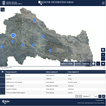
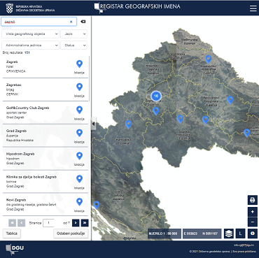
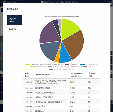
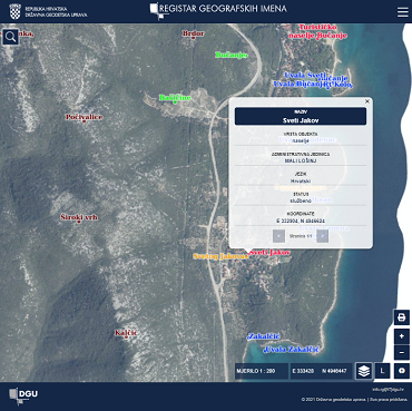
We developed an application for the Register of Geographic Names to standardize and harmonize them for collecting, recording, processing, understanding, connecting, researching, and publishing various spatial data for the State Geodetic Administration. Our goal was to ensure the accuracy, completeness, and consistency of the data used for official documents creation, as well as for national and international communication.
Client:
State geodetic administration (DGU)

Solution

The data in the Register of Geographic Names is structured for easy use and application at the international level, all countries have compatible formats, and share databases that are collected once and used multiple times. The data covers the entire Republic of Croatia territory up to the borders with neighboring countries, including the maritime part.

Result

The Registry application was programmed for DGU and since its creation 130000 location data have been collected that will be used in the future by all instances of the State Administration. RGI is the largest source of open spatial data in the Republic of Croatia. The application itself is upgraded every year and continuously maintained by LIST LABS team for DGU.
To visit the site, click here.